
ROMAN FRONTIER · SELLER-REPORTED c. AD 200–300
Roman Iron Arrowhead I
ONE IRON ARROWHEAD · 10-INCH DISPLAY
£74.95
Along the Danube, Roman garrisons, traders and families made a life beside a formidable river frontier. Journey through Noricum and Pannonia before discovering our framed iron-arrowhead collection.
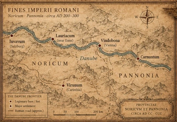 NORICUM · PANNONIA · THE DANUBE ENLARGE MAP ↗
The Roman frontier was not simply a line on a map. It was a living landscape of forts, towns, roads and river crossings.
READ THE STORY ↓Five individually framed iron-arrowhead displays, inspired by the military and provincial world of the Danube.
05 SINGLE EXHIBITSONE IRON ARROWHEAD · 10-INCH DISPLAY
ONE IRON ARROWHEAD · 10-INCH DISPLAY
ONE IRON ARROWHEAD · 10-INCH DISPLAY
ONE IRON ARROWHEAD · 10-INCH DISPLAY
ONE IRON ARROWHEAD · 10-INCH DISPLAY
Around AD 200–300, the Danube was one of Rome’s defining northern boundaries. Fortified positions at places such as Lauriacum, Vindobona and Carnuntum helped control movement through a frontier shared by soldiers, merchants, craftspeople and families. Roman roads, river traffic and settlements stitched these communities together.
Noricum and Pannonia covered parts of modern-day Austria and neighbouring areas. Our map highlights historical sites from that landscape; it does not identify the original findspot of any arrowhead in this collection.
The five iron arrowheads were purchased as a group described by the seller as Roman-period finds from an Austrian region, approximately AD 200–300. Their dating and origin are unverified, with no documented archaeological context supplied.
Preview only. Checkout remains disabled while artefact descriptions, final photography and payment acceptance are being prepared.